A Slow Look at a County from the Highest Public Viewpoint
A county landscape from a public viewpoint becomes easier to read when you follow ridges, watercourses and settlement patterns in a patient, repeatable order.
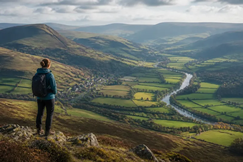
What can you actually read in a county landscape from its highest public viewpoint? A county landscape is more than a panorama: it is a set of connected forms, from ridges and river valleys to roads and settlements, that becomes clearer when you look slowly and in sequence.
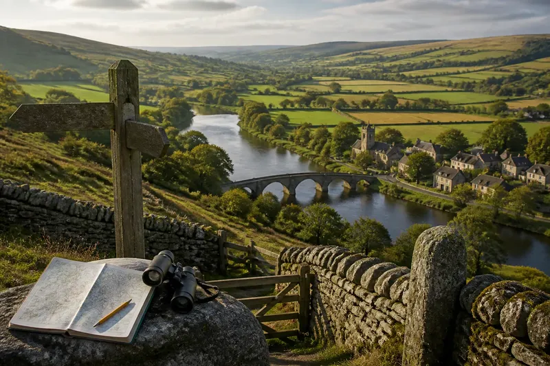
Choose a viewpoint that is legally open to the public, reached by an established route and safe for your abilities and the conditions. A signed hilltop path, a public observation platform or a roadside lay-by designed for viewing can all work. The aim is not to reach the highest point at any cost. It is to find a place where you can pause, see a meaningful span of country and relate its parts without stepping into danger or trespassing.
Start with the shape of the ground
Before naming villages or tracing roads, notice the land’s broad form. Does the county appear level, gently rolling, folded into ridges, or divided by a steep escarpment? Look for the largest changes in height first. They organise what you can see: a ridge may hide the ground beyond it, while a broad valley opens a corridor through the landscape.
Use the horizon as a simple reference. Find the highest continuous line of ground, then compare it with nearer slopes and lower areas. A distant ridge often looks softer and bluer than a nearby one because the intervening air reduces contrast. That visual difference can help you separate landforms by distance, but haze can blur the distinction. Treat it as a clue, not a precise measure.
Notice whether slopes face in the same direction or meet in a series of folds. Long, parallel ridges may suggest a landscape where harder and softer rock have weathered differently. Rounded hills and broad, shallow valleys give a different impression from sharp, steep-sided uplands. You do not need to identify the underlying geology to describe what is visible accurately.
It helps to distinguish a summit from a viewpoint. The highest point may be enclosed by trees, fenced, or too exposed to offer a safe place to stop. A slightly lower public spot can reveal more of the county because its sightline crosses a valley or faces an open slope. For reading a landscape, what the viewpoint lets you see matters more than its rank.
Read a county landscape from ridge to valley
Once the broad shape is clear, trace the ground downwards. Look for where slopes flatten, where a valley narrows, and where two valleys meet. These transitions often explain why routes and settlements appear in particular places. A gentler saddle between hills can offer an easier passage than a steep ridge; a wide valley floor may provide room for roads, fields and buildings.
Try to follow one continuous line of land rather than scanning every detail at once. Start at a visible ridge, track its crest until it dips or turns, then follow the slope towards lower ground. If the line disappears behind a nearer hill, note where it is hidden instead of guessing how it continues. That interruption is part of the view: the landscape is three-dimensional, and the viewpoint gives only one angle on it.
Now compare neighbouring slopes. A wooded face beside an open one might reflect differences in land use, exposure, soil or ownership. A patchwork of hedged fields can contrast with larger open fields or rough grazing. These patterns are visible, but their causes may not be. Describe the contrast first; use maps or local information later if you want to investigate why it exists.
Imagine you are standing on a publicly accessible ridge above a broad valley. A stream appears as a thin, reflective line, while a road follows the valley floor and a village sits on a lower slope. You could first mark the ridge and valley as separate landforms, then trace the stream towards its apparent low point and compare the village’s position with the road. The expected result is a more coherent account of how the visible features relate, without assuming that the road or settlement follows the stream exactly.
Follow watercourses without mistaking every line
Water is often easier to recognise by the shape around it than by the water itself. A river may be screened by trees or buildings, but a broad valley can reveal its route. Follow the valley’s lowest visible ground and look for bends, tributary valleys and changes in width. A river plain may appear as a level strip between steeper sides, though fields or development can make its edges hard to pick out.
Not every pale or dark line in a valley is a river. It could be a road, railway, drainage ditch, field boundary or shadow. Check how it behaves: a watercourse generally occupies low ground and may branch through smaller valleys, while a road may cross slopes or keep a steadier gradient. From a distant viewpoint, these are only visual possibilities. Binoculars can help, but they cannot replace a map when you need to identify a feature with confidence.
Look at how water seems to leave higher ground. Several small valleys may converge towards a larger one, producing a branching pattern. In another part of the view, a broad, shallow depression may have no obvious channel. The county’s drainage pattern can therefore be partly visible and partly concealed. Weather and season also matter: a stream may be more apparent after rain, while vegetation can hide it in warmer months.
Where a river crosses a settlement, observe the relationship rather than assigning a cause. Buildings may cluster near a crossing, spread along a valley, or sit above the floodplain. The view can show proximity and arrangement, but it cannot establish why a settlement began there or how water affects it now. Those questions call for maps, local records or authoritative flood information, not inference from a panorama alone.
Notice how settlements occupy the land
Look for the shape of built areas before trying to identify every place. A compact cluster may stand apart from dispersed farms; a linear settlement may extend along a road or valley; newer development may form a separate edge. These patterns can help distinguish the county’s settled lowlands from more sparsely built uplands, although the view rarely reveals where one community ends and another begins.
Roads make useful guides to the terrain. A route may curve around a steep slope, follow a valley, or cross a ridge at a lower saddle. If a road disappears, it may be screened by a fold in the ground rather than ending. Trace it only as far as you can see, and leave the hidden section uncertain. This keeps a visual reading honest and can suggest what to check on a road map later.
Settlement patterns and landforms often appear together. A broad, flatter area may show larger fields and more continuous building, while steep slopes remain wooded or open. Yet such contrasts are not rules: transport links, planning decisions and local land use also shape what is visible. A viewpoint can prompt questions about these influences, but the view alone cannot settle them.
For a useful comparison, choose two settled areas in the same panorama. Note whether each sits on a valley floor, beside a river, on a slope or near a route over higher ground. Then compare its visible shape: compact, strung out or scattered. This approach reveals differences without turning a distant visual impression into a claim about the county’s history.
What can you tell from a county viewpoint?
How do I choose a safe public viewpoint?
Use a signed public viewpoint, established path or designated stopping place, and check access information before setting out. Consider weather, daylight, terrain and your own mobility; do not climb fences, enter closed land or stop where traffic makes viewing unsafe.
Why do rivers sometimes disappear from view?
Trees, buildings, bends and low valley floors can conceal water even when the river’s route shapes the surrounding land. Follow the valley form, then use a suitable map to check the course rather than treating every line as water.
Can a panorama show why a town grew in one place?
It can show where buildings lie in relation to slopes, crossings and routes, which may suggest useful questions. It cannot establish the settlement’s origins or later decisions; local records and historical maps are better evidence for those explanations.
What should I record if I want to remember the view?
Write down the viewpoint, date, weather and the direction you faced, then sketch a few large features such as a ridge, valley and settlement. A simple note of what was clear and what remained hidden is more useful than a crowded sketch full of uncertain labels.
Make a small field record of what you see
A short field record turns a passing view into something you can compare later. Bring a notebook and pencil, or use a phone’s notes app. If you take a photograph, include the direction of view in your notes; a picture without orientation can be difficult to interpret once you have left the site.
Keep the record selective. You might note:
- The public viewpoint and the direction you faced.
- The most prominent ridge, summit or break in slope.
- The broadest valley and any visible tributary valleys.
- Where the clearest settlements sit in relation to slopes and roads.
- Which features were obscured by trees, buildings, haze or weather.
- One question to check later on a map or in a local record.
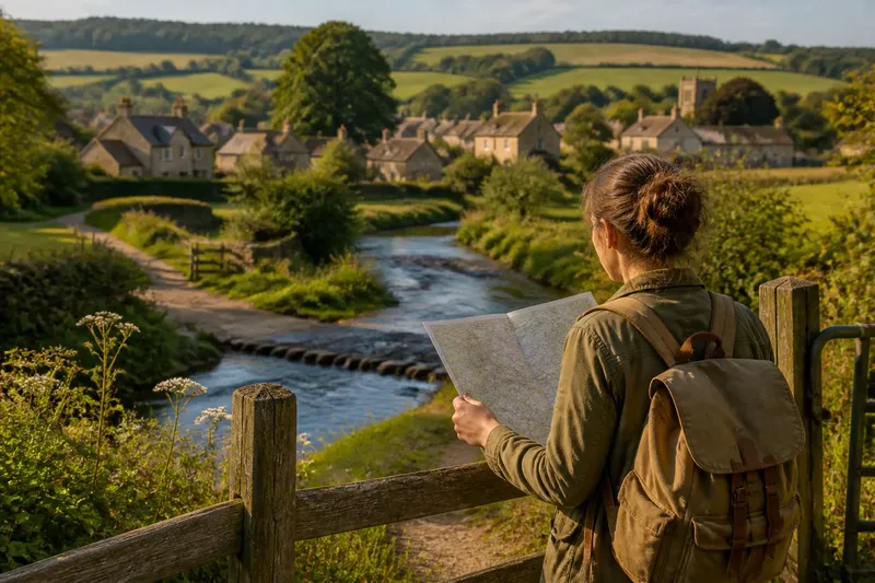
On an Ordnance Survey map or another dependable topographic map, compare the shapes you recorded with contour lines, which show changes in elevation. A map can confirm whether a valley bends, whether a ridge continues behind a nearer slope, and whether a road crosses a high point or a saddle. The field view and the map answer different questions: one shows how features appear from a particular place, while the other gives a structured account of their position and shape.
If you revisit the viewpoint in another season, do not assume that a changed appearance means the land itself has changed. Leaf cover, crops, mist and low winter light can alter visibility. Compare the underlying forms first, then note which surface details have become easier or harder to see.
A county landscape from a public viewpoint is easiest to understand when you keep sight and explanation distinct. Describe the ridge, trace the valley, notice where people have settled, and record what blocks your view. That patient order leaves room for discovery while giving you a reliable starting point for checking the landscape on a map when you get home.