How to Read a County Map’s Scale, Symbols and Blank Spaces
Learn how to read a county map’s scale, symbols and blank spaces so you can interpret its purpose and explain what its marks do—and do not—show.
What can you safely infer from a county map, and what should you leave undecided? Reading a county map well means identifying the conventions behind its marks: scale, symbols, lettering and the sheet’s purpose. These details help you explain what the map records without turning an omission into a claim about the landscape.
Start with the map’s purpose and scale
A map is made to communicate selected information. A county road map, for instance, gives prominence to routes and administrative limits; a geological map distinguishes kinds of underlying rock. Neither is intended to show every feature on the ground.
Scale is the relationship between a distance on the map and the corresponding distance on the ground. A map covering a whole county compresses local detail. A small settlement may appear as a dot, and a lane may disappear altogether. That is a design choice, not evidence that the settlement was insignificant or the lane did not exist.
Before interpreting a feature, check the scale bar, legend, publication date and any notes about the map’s purpose. If you are using a scan, resizing can change the apparent proportions. Treat the printed scale cautiously unless you know the image has retained its original dimensions.
Read symbols and labels as conventions
A symbol stands for a feature according to the map’s legend. A dot might mark a settlement, while a line might represent a road, river or boundary. The legend tells you which meaning applies on that particular map; familiar-looking symbols do not always have the same meaning across different editions.
Labels identify places and features, but their position is not necessarily exact. A village name may be shifted to avoid covering a road, or it may refer to a wider area than the cluster of buildings. Letter size can suggest relative prominence within the map’s design, but it does not by itself establish a place’s population, status or precise limits.
Keep three things distinct: the name printed on the map, the symbol used to locate it, and any line that marks a boundary. They may refer to related things, but one does not automatically explain the others.
Interpret blank spaces without filling them in
An unmarked patch tells you only that the map does not show a feature there. It might be open ground, woodland, scattered buildings or an area left plain to keep the sheet legible. The map alone may not distinguish among those possibilities.
Choose a further record according to the question, rather than looking for a single source to settle everything. A larger-scale local plan may show lanes and buildings; a directory may name institutions; a land-use map may classify broad kinds of ground. Check each record’s date and purpose before treating its details as evidence for the same moment or subject.
- Check the map’s date; if it predates the period you are describing, then use it only for earlier conditions and seek a closer-dated source for later changes.
- Check the scale bar; if it is absent or the scan may have been resized, then avoid judging distances from the image and locate an undistorted copy before measuring.
- Check the legend for the symbol beside a settlement; if the symbol is defined, then describe only that mapped feature, and if it is unclear, then consult the map notes or another edition.
- Check whether a name is attached to a boundary line; if a line is present and identified in the legend, then describe it as the mapped boundary, and if not, then do not infer a boundary from the label’s position.
- Check whether the blank area is relevant to your question; if it is, then consult a source designed to show that feature, and if it is not, then state that the county map leaves it unmarked.
- Check whether two records cover the same date and subject; if they do, then compare their mapped features, and if they do not, then explain the difference in date or purpose rather than calling one an error.
Why does a county map omit or simplify features?
Does a county map show every settlement?
No. A county map may omit small settlements or reduce them to a symbol so the larger picture remains readable. A more local map may show additional detail, but its symbols and purpose still need checking.
Does a place-name label mark an exact location?
Not necessarily. The label may identify a broader locality or be moved for clarity, so use a mapped point or an explicit boundary line only when the legend supports that reading.
Can a blank area be treated as unoccupied?
No. The absence of a mark is not evidence that nobody lived or worked there. Look for a record intended to show the feature you are investigating, and state any remaining uncertainty.
What should I compare before describing a map difference?
Compare the maps’ dates, scales, legends and stated purposes. A difference may reflect changing conditions or different selection rules, so describe what each map shows before offering an explanation.
A worked example keeps the claim within the evidence
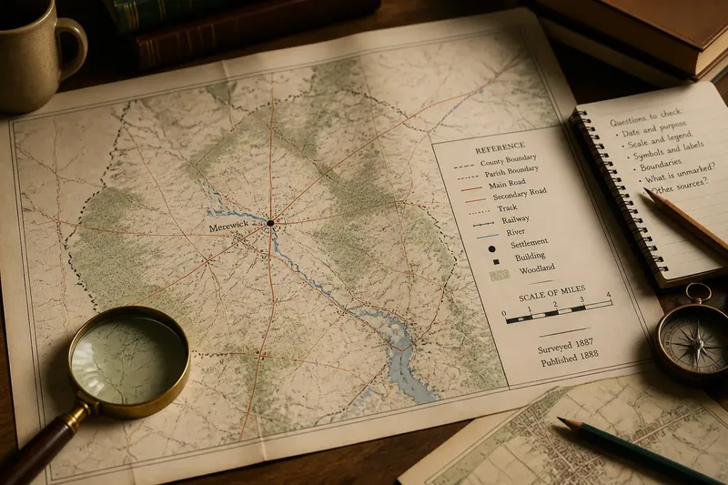
Say you are preparing a display about an invented place called Merewick. Your starting material is a county map dated to an earlier period, with a village dot, a river line and a blank area between them. You want to describe whether the map shows a route from the village to the river.
First, you read the legend and find that the dot marks a named settlement, while the river line marks a watercourse. There is no path symbol in the blank area. You then check the scale and date, and record that the sheet is designed to show county-wide features rather than every local track. Next, you consult an invented larger-scale parish plan from a different date; it shows a lane, but its date does not establish that the lane existed when the county map was made.
Your resulting caption says that the county map locates Merewick and the river but does not show a route between them. The later parish plan depicts a lane in the area, without confirming when it first existed. This gives visitors a clear distinction between what is mapped and what remains uncertain.
Use the map for the question it can answer
A county map is most useful when you treat its marks as evidence shaped by scale and purpose. Read its legend, date and labels before making a claim, and identify omissions as omissions rather than proof of absence. When you need detail the sheet was not designed to carry, name the specific question and choose a record suited to answering it.
For a display, caption or local history note, include the map’s date and explain what its symbols mean. That small piece of context lets readers judge the evidence for themselves and keeps your account precise even where the record falls silent.